New NRDC site features visions of urbanism across the country

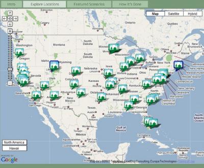
Last month, NRDC launched an interactive web site featuring transformative visions of how smart growth development could be implemented across the country. The visions are very much within the new urbanist lexicon.
Working in partnership with Steve Price and the wizardry of his firm Urban Advantage, we chose 70 sites from around the country on the basis of geographic and development type diversity. We then integrated step-by-step scenarios on those sites, each of which begins with an actual photograph, with Google Maps technology to create a robust user interface. Users can go to a map of the US, zoom in on a location of interest, and choose a site; they will then be taken to a satellite image of the site, some contextual information about the metro region in which the site is located, and a sequential visual transformation of the site from potential to walkable neighborhood.
Users can also employ a checklist of site and/or development characteristics to narrow down the choices and see only those transformations that fit their interests.
Our primary goal is to educate our environmental constituency on the potential of transformative, smart urbanism. But of course we hope it will prove useful to professionals and CNU's constituency as well. You can access the site, Picturing Smart Growth, directly or begin with my introduction to it here and my how-to-use-it post here.


Comments
Write your comments in the box below and share on your Facebook!