A Civic Vision for the Riverfront
Location: Philadelphia, PA, USA. riverfront
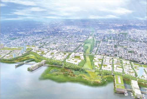
This riverfront plan provides a vision for the future of one of Philadelphia's major cultural, ecological, and economic assets. Its location along one of the world's great working rivers, its proximity to the strong center city real estate market, its vibrant neighborhoods to the west, and the stunning sweep of history along its shores place it among the most important development areas in the region today. With more than 1,100 acres of land stretching over seven miles at the center of the metropolis, the plan offers a prime opportunity to reverse the trend of regional expansion through greenfield development and encourage the reclamation of undervalued land along the shores.
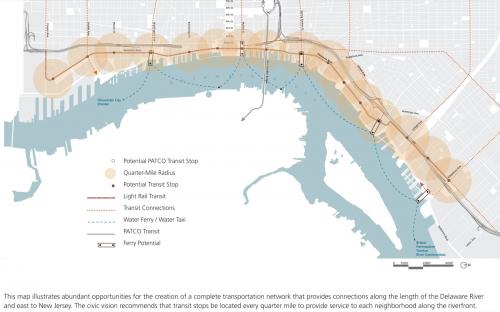
The plan is based on planning principles grounded in the values and civic aspirations of more than four thousand citizens, who participated in a year-long public planning process. The civic vision was based on a set of three networks that establish a framework for growth: Movement Systems- streets, public transit, and trails, Parks and Open Space- parks and ecological systems, and Land Development- mix of uses and income levels.
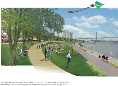
These improvements, when implemented over time, will provide a framework for over 500 acres of development, increase property values, and support a higher quality of life. In short, the plan calls for bringing existing neighborhoods to the river's edge with mixed-income, mixed-use, transit-oriented development that extends the traditional 18th century grid, and the implementation of sound economic policies and redevelopment controls to enable the creation of a dense but humane urban riverfront.
Lessons learned: An open and transparent process, funded by private foundations and led by a university's non-profit consultant arm, overcame the most common barriers to the creation of good urbanism- a governmental planning and design environment weighted down by conflicts of interest created by the structure and operation of the city's planning and development approval process. To ensure ownership in the plan at all levels, the project team engaged government and civic agencies at all levels- including transportation and transit agencies, district stakeholders, the design community, and the general public- in a series of best practices and technical design workshops, advisory group meetings, and three day charrettes that drew over 500 participants.
Transect Zone(s): T6 core.
Status: Proposed
Guiding Charter Principle(s): Principles 4, 10, 11, 12, 13, 14, 17, 18, 19, 25
Project or Plan's Scale: City
Features: Affordable/subsidized housing, Civic buildings & parks, Mixed uses, Transit oriented development, Waterfront.
Land area (in acres): 1150
Total built area (in sq. ft.):
Total project cost (in local currency):
Retail area (in sq. ft.):
Office area (in sq. ft.):
Industrial area (in sq. ft.):
Number of hotel units:
Number of residential units (include live/work):
Parks & green space (in acres): 300
Project team designers: Wallace Roberts & Todd, LLC
Project team developers: PennPraxis- University of Pennsylvania School of Design/ Harris Steinberg
Previous site status:
Starting/Ending date of construction/implementation: -


