Connectivity and Continuity: Returning Philly to Waterfront
Location: Philadelphia, PA. Metropolis, City, and Town
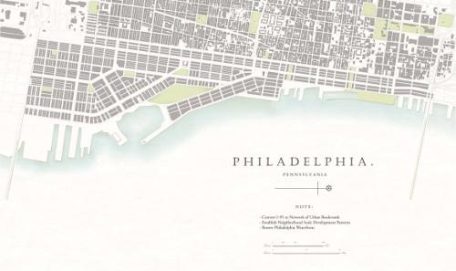
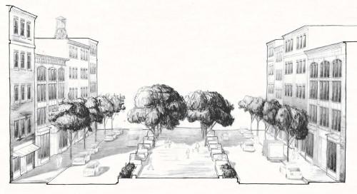
Submitted by the Students for New Urbanism: Notre Dame, the proposal suggests replacing a vast stretch of urban highway—which acts as a physical barrier to Philadelphia residents and their waterfont—with more context-sensitive solutions. The elimination of this impediment would prove symbolic and a catalyst for the strengthening and the restoration of once vibrant neighborhoods. Extending the traditional grid via a dispersed network of streets and boulevards solves the problem of safe and efficient automobile and pedestrian travel. Establishing a neighborhood-development phasing program, the Project provides a model for sustainable future growth while leveraging Philly’s waterfront as a public asset.
Transect Zone(s): T4 general, T5 center.
Status: Proposed
Project or Plan's Scale: Metropolis
Features: Waterfront.
Land area (in acres): 503
Total built area (in sq. ft.):
Total project cost (in local currency):
Retail area (in sq. ft.):
Office area (in sq. ft.):
Industrial area (in sq. ft.):
Number of hotel units:
Number of residential units (include live/work):
Parks & green space (in acres):
Project team designers: Students for New Urbanism: Notre Dame
Project team developers: N/A
Previous site status:
Starting/Ending date of construction/implementation: -


